
Wetland Plant Identification and Ecology course with Wetland Revival Trust
A notable privilege of the Landcare facilitator role is awarded in what’s described as Professional Development (PD) or the learning experiences that come of wanting to further your expertise for ongoing career growth. In this instance, one can mark days off the working calendar to stand ankle deep in the freshwater of one the most beautiful natural wetland environments in the state, whilst indulging in teachings about frogs, fish, birds and plants, by passionate individuals who will then provide a lunch so delicious that six months later, you’re still thinking about the satay sauce. With thanks to the Wimmera CMA for the indulgence, this was my most recent foray into PD in undertaking the Wetland Revival Trust’s Plant Identification and Ecology course at Wirra-Lo Wetlands.
Situated in Murrabit West, the Wirra-Lo wetlands are a complex of swamps, creeks and depressions across 180-hectares of former dairy-farmed country managed by the Wetland Revival Trust (WRT), and the classroom for the WRT Plant Identification and Ecology course. The private property is covenanted for environmental restoration and protection of valuable habitat and vulnerable species, including nationally vulnerable growling grass frogs and endangered Australasian bittern. The system of wetlands and floodplains receives environmental water and is designed to support habitat for threatened wetland species, under the management of director and ecologist Damien Cook and in relation to Traditional Owners and partners.
The course takes place over three separate days in October, December, and April, to illustrate ecological differences and seasonal changes to plant communities across the wetland environments in line with natural patterns of wetting and drying.
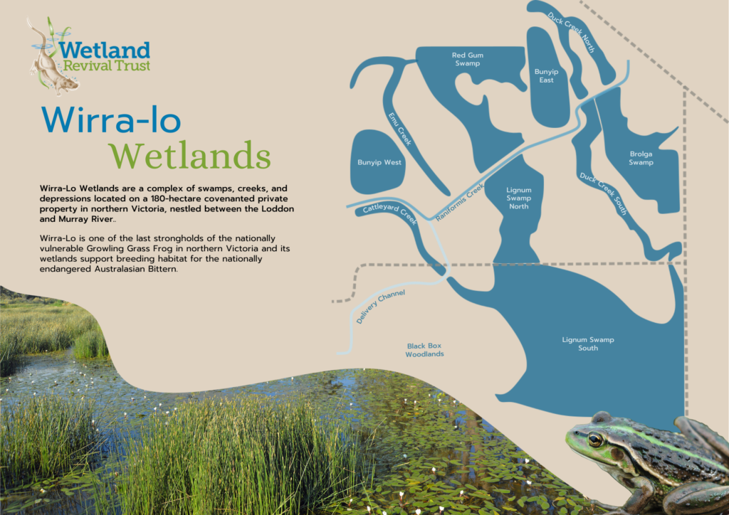
Wirra-Lo Wetlands map, property of the Wetland Revival Trust.
Damien and WRT ecologist Cassia Reid were our course leaders, and after an introduction game of catch-and-tell with a pair of Damien’s socks (clean, we were assured), the class of approximately 20 natural resource management (NRM) professionals, Landcare personnel, Traditional Owner’s and community members from across the state were guided through welcomes and inductions before Day One in the field began.
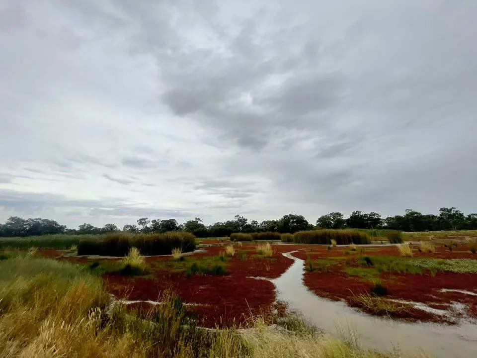
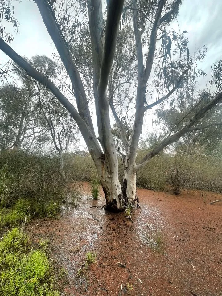
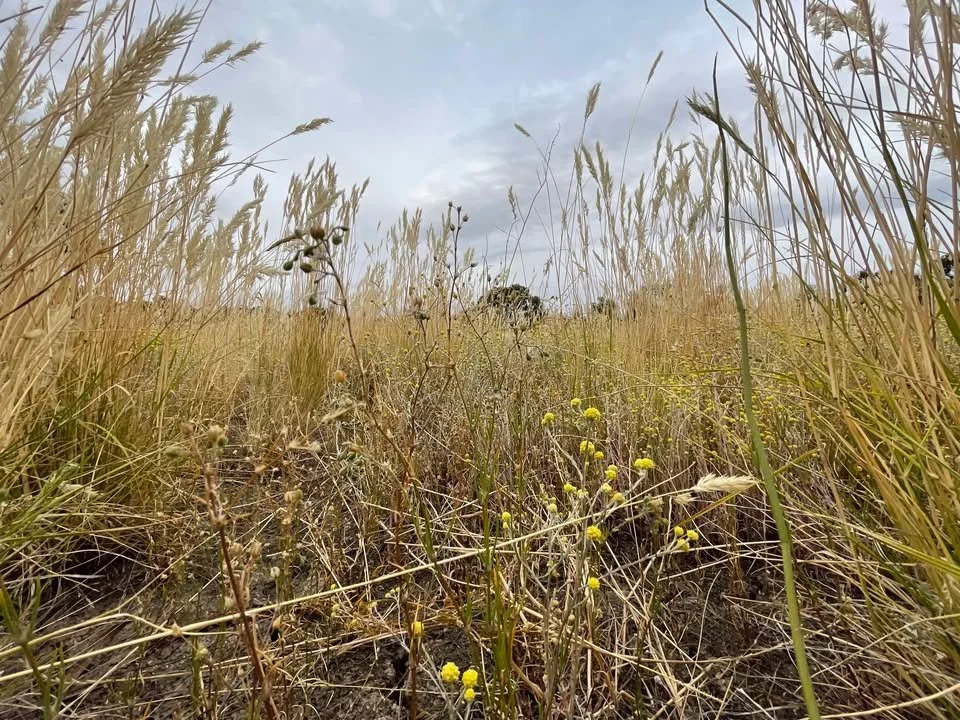
The field - Lignum Swamp North, October 2025
Day One - October 2025
Common Grasses, Sedges, Rushes, and Cumbungi of the Southern Murray Darling Basin
Notably, the WRT ecology course began with a simple and quiet meander, where participants were encouraged first to connect with the land before divulging into the science of species identification.
We were encouraged to wander the woodlands or enter the water if desired, with waders the preferred attire for OHS but naked toes quietly permitted for those without their gumboots, to remember the natural connection between the human species and psyche and gentle Earth spirit. Observation is a critical skill for ecological assessment, coupled with the capacity to tread lightly and respectfully across landscapes, be it in pursuit of a timid endangered species or something likened to God in mindful practice.
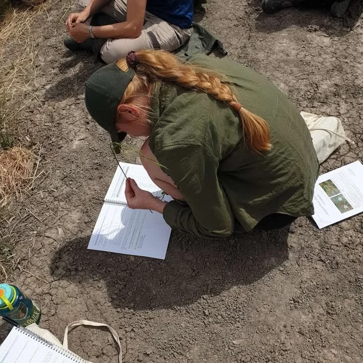
Connected to place, the class assembled at the first site to share our experiences of quiet observation and reflection before jumping into the basics of ecological assessment as per the WRT course workbook. Here, the students were introduced to techniques of reference, including photo points and landscape mapping with a focus on changing EVCs. Aided by the workbook and WTR field guide, we tried our hand at basic landscape mapping of the cross section of woodlands to wetlands; from the highest dry ground to the waters’ low depth, an exercise to be repeated over each of the 3 days of the course. The mapping exercise began the first introduction to commonly found wetland species, which in the spring is predominant of sedges, rushes and grasses and the focus of Day One’s plant identification. We were lead through identification techniques of these three key species, noting horticultural basics in identifying monocotyledons from dicotyledons, and the idiosyncrasies of leaf patterning, petal number, and structure of stem as determinants of classification, further guided by Damien and Cassia in how to identify the finer characteristics of species visible to the naked eye and announced to the physical touch.
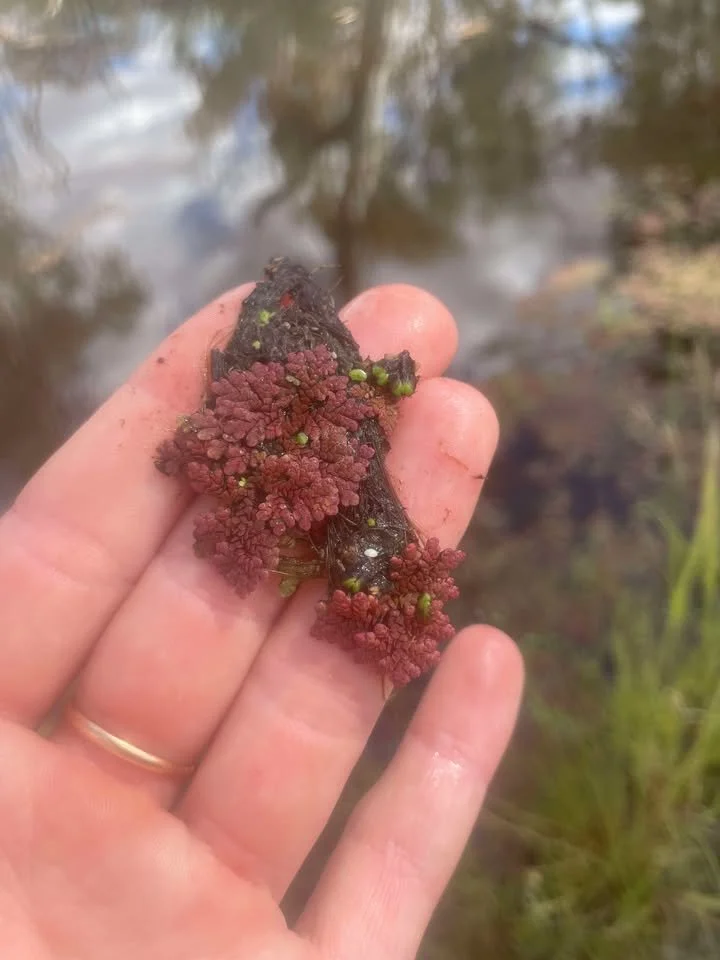
Post lunch the class was divided into two activities determined by our learning requirements and noting the differences between ecological expertise in the group. Where one group were keen to explore juncus under the microscope for keying out species, the other remained amongst the flies with field guide in hand to explore further species growing in the water, including growling grass frogs calling their interests, and indulge in the poetic whimsy [above] of the day.
As informed by the wise words of esteemed botanist Damien Cook, perhaps needless to say, the external classroom and affable teaching style of the WRT course leaders, not to mention the squadron of boisterous pelicans making themselves at home in a grand old tree on the lignum swamp at the close of the day, promptly banished any apprehension that might have been felt by those daunted by plant ID and botanical sciences.
Endangered growling grassfrogs calling from Redgum swamp
Day Two - December 2025
Common Aquatic Plants of the Southern Murray Darling Basin
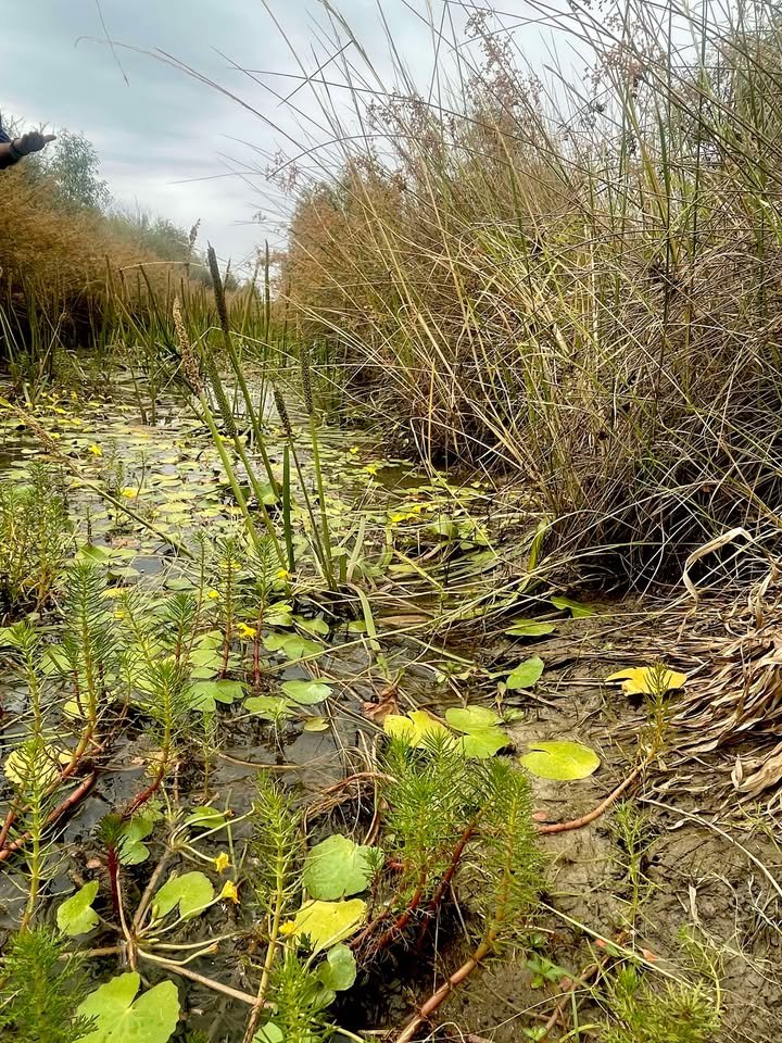
Where having a connection to nature might come with the job description for many NRM professionals and interested persons, Day Two began importantly with another nature connection walk - a welcome activity for setting the tone of the day and course. The coursework itself began at the first photo point location as Day One, where until lunchtime the class enjoyed time spent in the wetlands identifying plants where the water had receded as per natural seasonal changes. The morning of assessment, between enticements of homemade cake for morning tea, included a site stroll that loosely mapped changes of different plant communities across varying vegetation zones in the drawdown phase of wetland water. Here students were introduced further to determinants of wetland zonation and the ecological roles of floating and submerged aquatic plants.
After another newsworthy lunch catered by Lee the camp chef, the classroom re-adjourned for further wetland explorations at the Red Gum creek for species I.D.
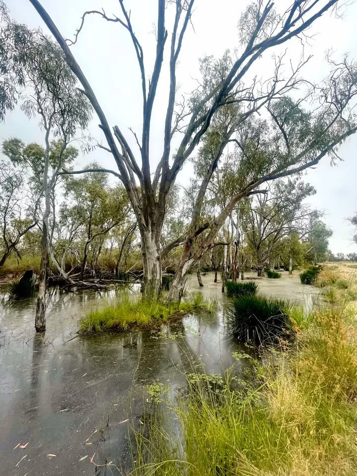
Damien guided a venture around Wirra-Lo for the class to discover and sample traditional bush food in the edible tubers of water ribbons, sp cycnogeton multifructum, of which were morish and surprisingly sweet. The day concluded in yet another vegetation zone of riverine grassy woodland where, after having been let to dry for months, was prominent in grassland plant communities yet to be explored by the students, including species of brightly coloured blue devil eryngium ovinum prominent amongst other endangered plants. The unexpected grassland species amongst the drying wetlands exemplified further the importance of working with natural environments, as demonstrated by the WRT at Wirra-Lo, and allowing for seasons of dry to preserve symbiotic relationships between natural ecosystems and vegetation communities and zones. On the lignum swamp, spoonbills, countless ducks, and swans paddled across low water, taking advantage of the abundant food sources, whilst the pelicans had moved on.
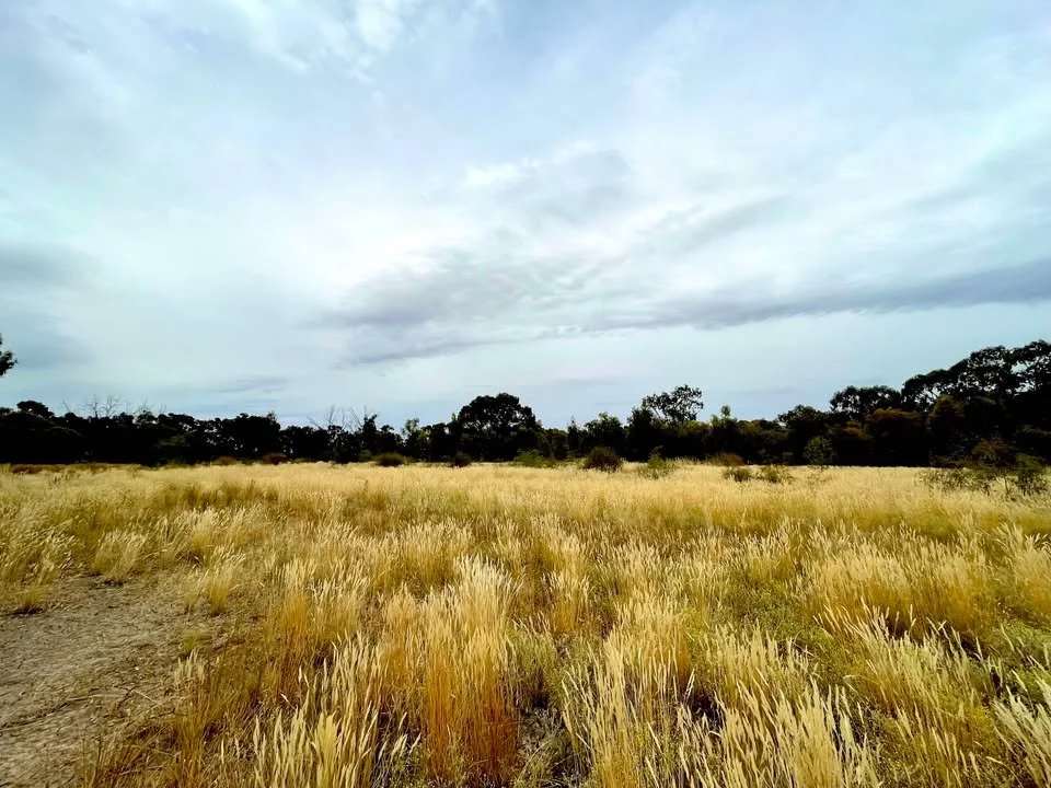
A riverine grassy woodland amongst the swampy wetlands and at Wirra-Lo.
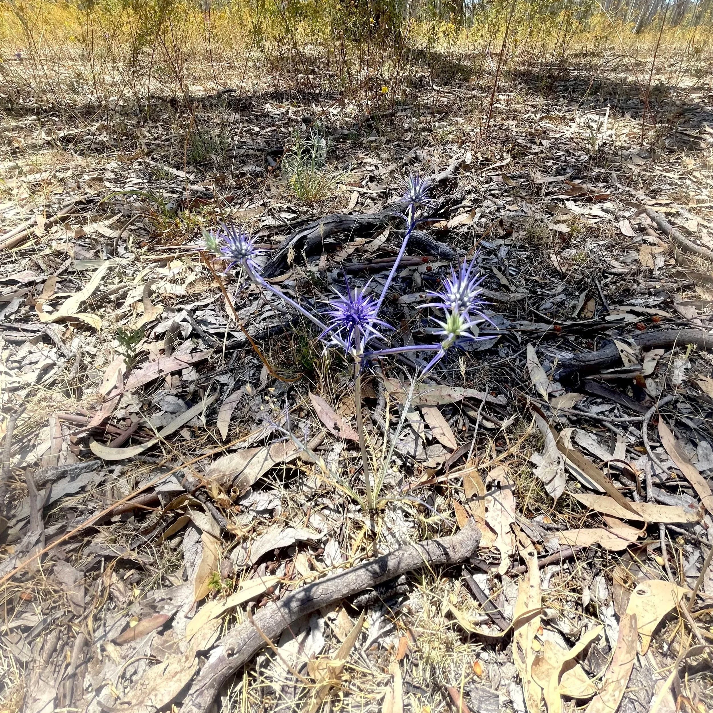
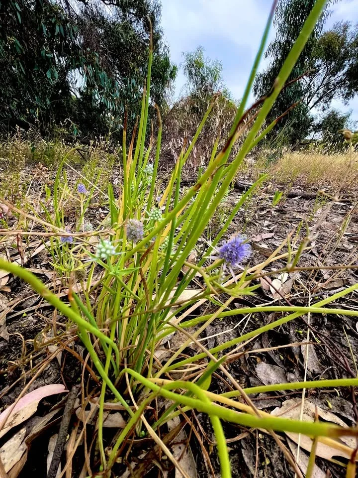
Species Eryngium Ovinum, commonly Blue devil, and a personal favourite.
Day three - April 2026
Common Mudflat Plant Species of the floodplains and lakes of the Southern Murray Darling Basin
Day three of the course focused on mudflat species and the ecology that emerges after the water recedes in the dry season. As a special highlight, prior to starting formal coursework the day featured the opportunity for students to get our hands dirty in helping revegetate a section of the wetlands with the WTR works team. Though hard ground, the holes were drilled so that various aquatic species could be planted and guarded, before the temporary banks were removed for the water to flow through.
![Image[1].jpeg](https://images.squarespace-cdn.com/content/v1/64c84dec7388967e1667dab7/1777332701884-M6PPNLKR6G1MNF0FPIS9/Image%5B1%5D.jpeg)
![Image[7].jpeg](https://images.squarespace-cdn.com/content/v1/64c84dec7388967e1667dab7/1777332730782-SB36QYDDHE1J7CIV15SK/Image%5B7%5D.jpeg)
![Image[9].jpeg](https://images.squarespace-cdn.com/content/v1/64c84dec7388967e1667dab7/1777332743354-GZXY6MOK7ALNL8SP0BQ9/Image%5B9%5D.jpeg)
![Image[10].jpeg](https://images.squarespace-cdn.com/content/v1/64c84dec7388967e1667dab7/1777332744924-BKQXFEDSWKW85YV1768P/Image%5B10%5D.jpeg)
Fingernails dirty and happy, we moved on to the coursework which lead students through the characteristics of mudflat species. At our first classroom point - the same site and photo-point as day one and two, students were invited to examine species emergent in the drying base of the receding wetland water, and with a focus on herbaceous species, we were taught about the adaptations of mudflat plants. The classroom expanded into a casual saunter around Wirra-Lo and we were encouraged to key out species as guided by Damien and WRT field guide. The day of touring included examining dry floodplains for vegetation abundant with seed for collecting, while Damien detailed how the seasonal watering patterns are delivered to best support the different habitats and wetland environments, for all species of flora and fauna that reside there.
![Image[3].jpeg](https://images.squarespace-cdn.com/content/v1/64c84dec7388967e1667dab7/1777331458939-NIWKJD47W99AR23AF443/Image%5B3%5D.jpeg)
![Image[2].jpeg](https://images.squarespace-cdn.com/content/v1/64c84dec7388967e1667dab7/1777331450182-2U2YRDEWUECIG1TA619K/Image%5B2%5D.jpeg)
![Image[11].jpeg](https://images.squarespace-cdn.com/content/v1/64c84dec7388967e1667dab7/1777331492431-4C4RAKNH7E3V163EBDKF/Image%5B11%5D.jpeg)
![Image[5].jpeg](https://images.squarespace-cdn.com/content/v1/64c84dec7388967e1667dab7/1777331472195-1UKHOIBPB8LR84HF0H8Q/Image%5B5%5D.jpeg)
![Image[1].jpeg](https://images.squarespace-cdn.com/content/v1/64c84dec7388967e1667dab7/1777331394507-ZH76VY9PB91KDU59THUB/Image%5B1%5D.jpeg)
As one might expect from an ecology and plant identification course, the WTR experience was rich in teachings for species ID and understanding the ecological drivers and hydrological phases that influence wetland species across varying vegetation zones. The WTR field guide offered a practical format for beginner botanists in understanding common wetland species characteristics and served as a convenient aid to the wealth of knowledge both Damien and Cassia bestowed generously throughout the course. In observing the wetland complex over six months and across different phases of water, we saw lifecycles of plants and their impacts to habitat for various species of fauna, whilst documenting the adaptability of nature to survive across seasonal changes. Rather charmingly, Wirra-Lo and her stewards promoted equally the value of connection between species and landscape, including and importantly the human species, for sustainable management of natural environments. With the sun setting on the experience, we watched the pelicans return to their perches in the lignum swamp trees; they had only recently returned to the site after having moved on when the water was at its lowest over the summer months, returning with the new flow of environmental water.
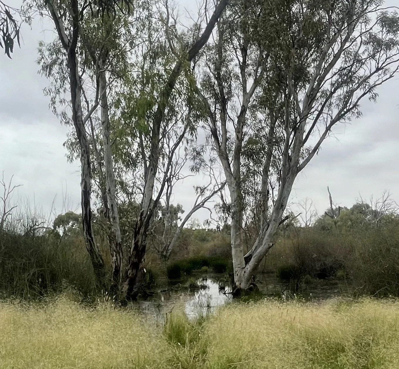
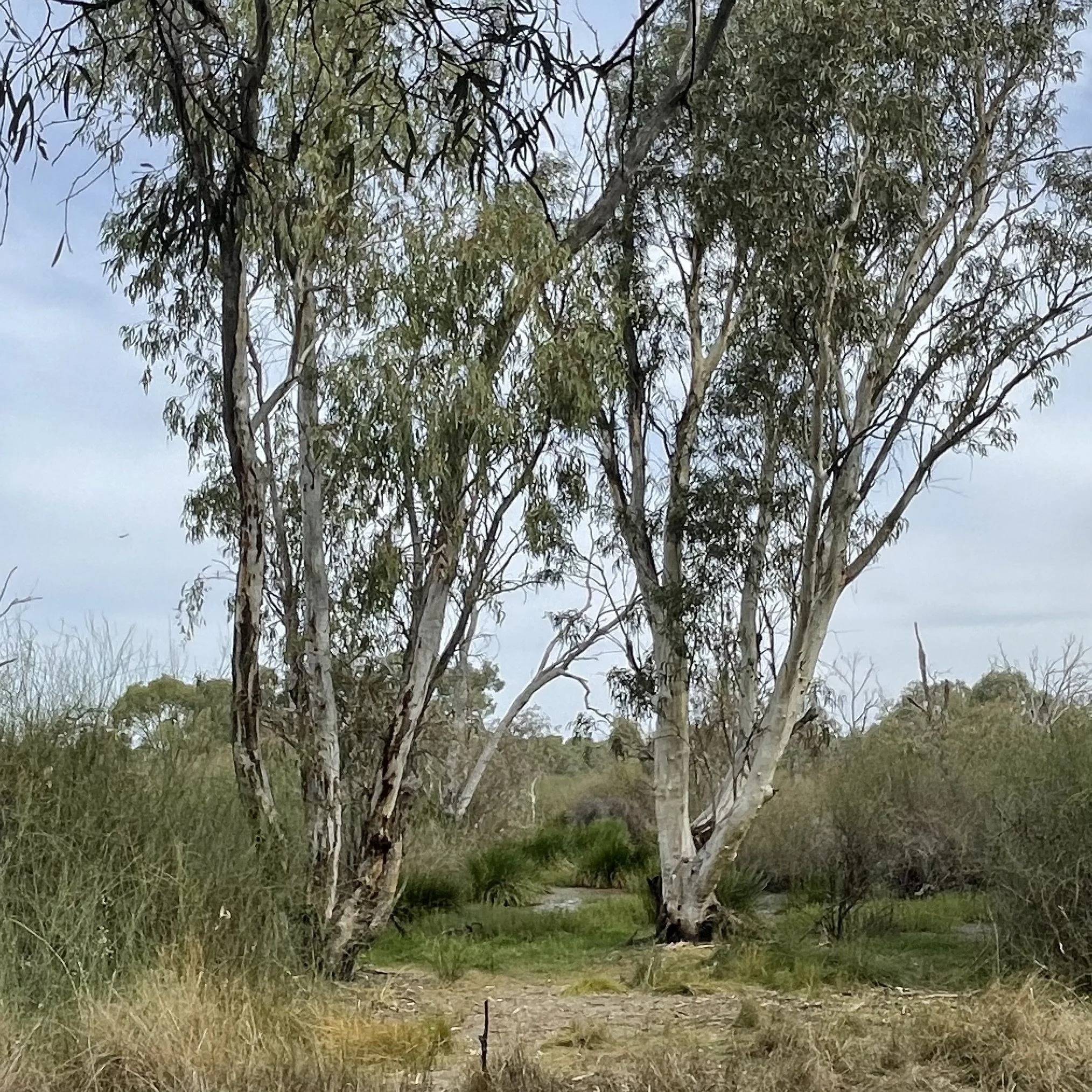
Photo points are used as ecological assessment tools when looking at seasonal changes across natural environments, capturing the differences to water levels and vegetation from the one vantage point, as seen below:
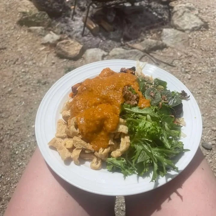
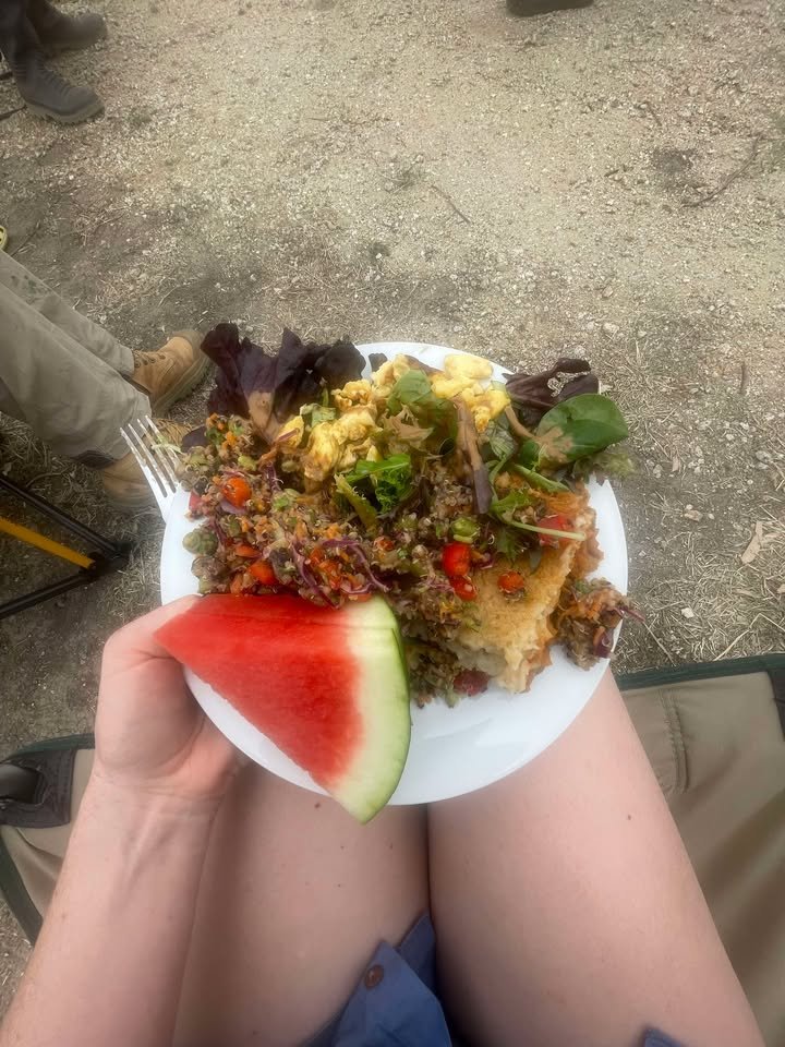
One critical highlight of the course was the catering by which we indulged in hearty lunches each day with special thanks to camp chefs Lee and Damien for their culinary delights.
![Image[8].jpeg](https://images.squarespace-cdn.com/content/v1/64c84dec7388967e1667dab7/1777331561605-PFPBWHXKGU8N7BGWGNFY/Image%5B8%5D.jpeg)